Maps Galore
Showing posts with label
PLSS
.
Show all posts
Showing posts with label
PLSS
.
Show all posts
Sunday, July 27, 2014
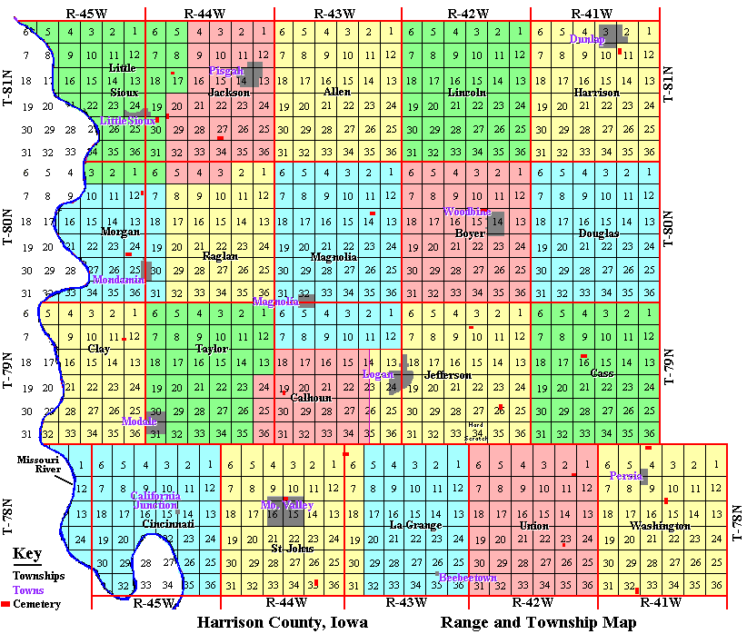
PLSS Map
http://iagenweb.org/harrison/twp/rangemap.htm
This above is a combination map, representing both Civil Townships (colored areas), and PLSS Townships and Ranges (squares outlined in
red
).It was obtained from the Iowa Genweb site.
Older Posts
Home
Subscribe to:
Posts (Atom)